Google Maps has long set the standard for how maps and navigation
apps should function on a smartphone. On your Android device, it’s
likely one of the best apps
you use, and it’s even better once you start poking and prodding its
settings panel. But are you getting everything you can out of Google
Maps? Google just expanded its Parking Difficulty feature with Find
Parking assistance in 25 U.S. cities. Let’s start with this tip first.
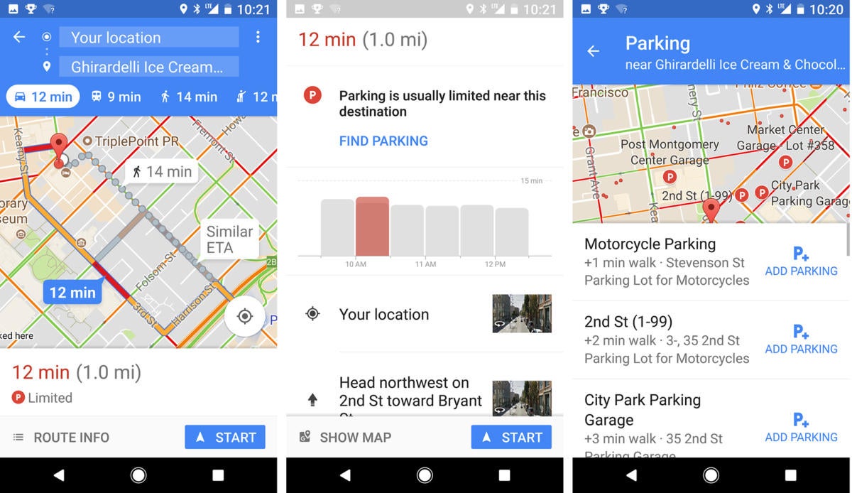
Find parking lots with three quick taps
Navigating
to a destination is just step one. Once you get there, you also have to
park, which can be a challenge in many cities. Lucky for us, Google now
offers parking assistance directly in the Maps interface. Google
Parking in San Francisco sucks. But Google can make it just a wee bit easier. Go
into Maps, choose car navigation, and then input your destination. At
the left-hand bottom of the display, you may see a “Limited” parking
notation, like in the first screenshot above. Tap the notation, and
you’ll see a chart indicating peak parking congestion, along with an
invitation to “Find Parking” (see middle screen above). Click that
notation, and you’ll see a list of convenient parking garages (third
screen).
If you click an “Add Parking” icon, Maps will add the
parking lot to your itinerary, and the interface will even show you
walking directions from the parking lot to your final destination.
Cool
indeed, but for now Find Parking is only available in the following
U.S. cities: Atlanta, Boston, Charlotte, Chicago, Cleveland, Dallas/Fort
Worth, Denver, Detroit, Houston, Los Angeles, Miami, Minneapolis/St.
Paul, New York City, Orlando, Philadelphia, Phoenix, Pittsburgh,
Portland, San Diego, Sacramento, San Francisco, Seattle, St. Louis,
Tampa and Washington DC.
Share your location with a loved one
Did
you know this used to be an option available inside Google+? Well, the
writing’s on the wall for Google’s ill-fated social network, which is
why Google bundled location sharing into Google Maps instead. Google
Share your location with a loved one so that they always know where you are. Always. To share your location, open Google Maps and then tap the hamburger menu in the top-left corner of the app. Now tap Share location to
get started with the setup process. You can share your location for a
specific length of time with whomever you specify from your contacts.
Once you’ve selected your contacts, you’ll get a prompt letting you know
those people can view your route.
You can also create a shareable
link of your locale for pals who don’t typically use Google Maps. This
lets them see your trek in a web browser.
When
you’re finished driving or walking—or you’re simply ready to go off the
grid—you can opt to stop sharing your location from the same menu
screen.
You can also share your trip’s progress if you’ve got a
long commute ahead. I use this particular feature with my husband,
because we both drive at odd times throughout the day. The feature lets
me know if he’s okay—and sometimes I use it to figure out if he’s close
enough to bring home my favorite takeout.
Add stops along your route
Google
Keep your family entertained on the road trip by adding stops along your route. There’s
nothing worse than being on the road and having no idea where to pull
off for that much-needed rest stop. Fortunately, Google Maps lets you
plan your route in increments. For instance, if you’re dying to try out
that vegan fast food joint on the way up to Mendocino County, you can
add it as a stop along your route.
From the Google Maps app, tap
the menu option in the upper-right corner of the app and select “Add
Stop.” The app will add another line for you to search for a locale.
After you’ve located it, you can adjust where it falls on your route
timeline by tapping the entry and dragging as necessary.
After you’ve planned out your route, tap Done,
then tap the same menu button to add a shortcut to your home screen.
It’s a good idea to do this in case the Maps app crashes (it happens!),
or you’re planning out routes ahead of time and need to save your
progress.
Find something to do
Google
Don’t get bored. Find something to do by typing in “things to do.” Let’s
say you didn’t have time to plan out your route to Disneyland—and
you’re not exactly a fan of Yelp’s rambly reviews. Google offers its own
system for reviews of restaurants and places, and you can tap into them
if you’re in a bind with nothing to do.
Launch Google Maps and type things to do near me.
Maps will find your locale and then immediately display a list of—what
else?—things to do. You can summon more accurate results by adding a
specific location to your search criteria. For instance, I typed in
“things to do in Buellton,” and Google immediately directed me to Ostrichland USA. Play around with the “near me” search syntax, because the right keywords can help you find pretty much anything you need.
Download offline maps
Google
By downloading maps directly to your phone, you’ll avoid having to rely on spotty wireless service. I
try to stick to walking and the subway whenever I’m in New York City—it
makes me feel like a local. But I often don’t have cell service
underground, forcing me to disembark before planning my Maps route. It’s
a waste of riding time!
Google Maps’ offline maps offer significant help in these situations, and they’re also useful if you’re trying to save on data. On your phone, launch Google Maps and then search for an area. Once it loads, tap More Info, and then the menu button in the upper-right corner. Tap Download offline map to begin.
If your smartphone comes equipped with an additional expansion slot, you can save offline maps to the SD card by tapping Settings on the main menu screen, and then Device > SD card.
Program your home and work addresses
Google
Let Google Maps be your north star by programming your home address ahead of time. If
you’re constantly inputting your home and work addresses in Google Maps
for driving directions, you might consider programming them, so they’re
always offered as destination options. In the main Google Maps menu,
select Settings and tap the top option, Edit home and work. From here, enter the addresses as needed.
I
work from home, so I set my “work” address as the nearest train station
so that Google always has travel times ready as I catch transit into
the city. You can program additional places, too, by searching for the
location on the main map. Then, tap More info > Label.
Google Maps: Find Parking and other features you need to start using
Reviewed by GsmCrack Box
on
September 01, 2017
Rating: 5
 Google
 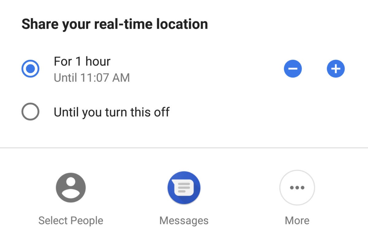 Google
 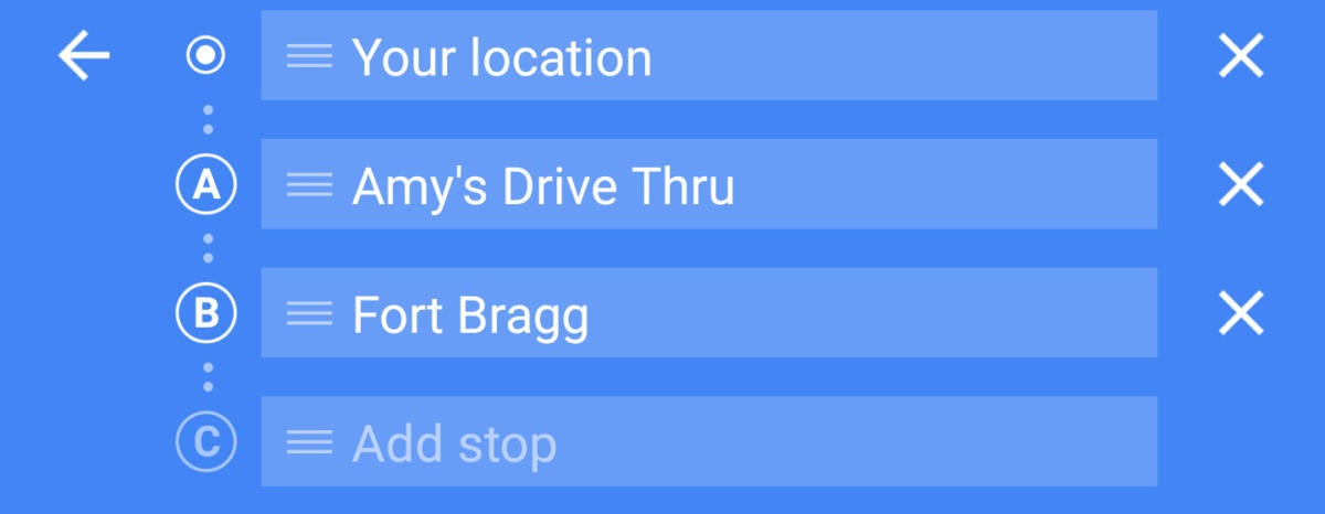 Google
 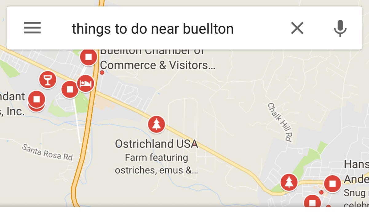 Google
 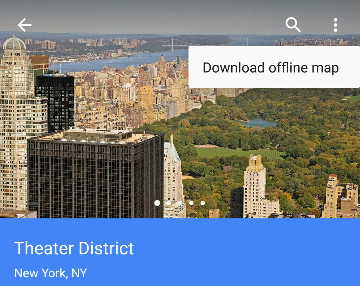 Google
  Google
 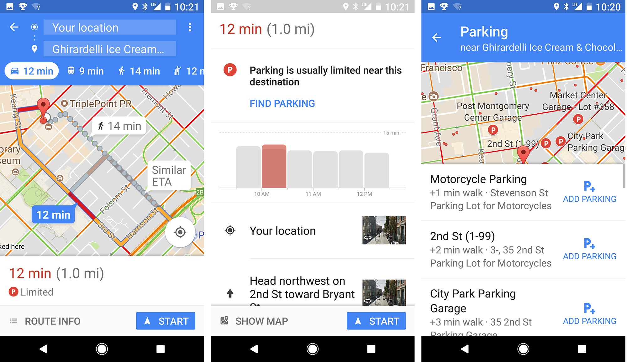 Google
  Google
 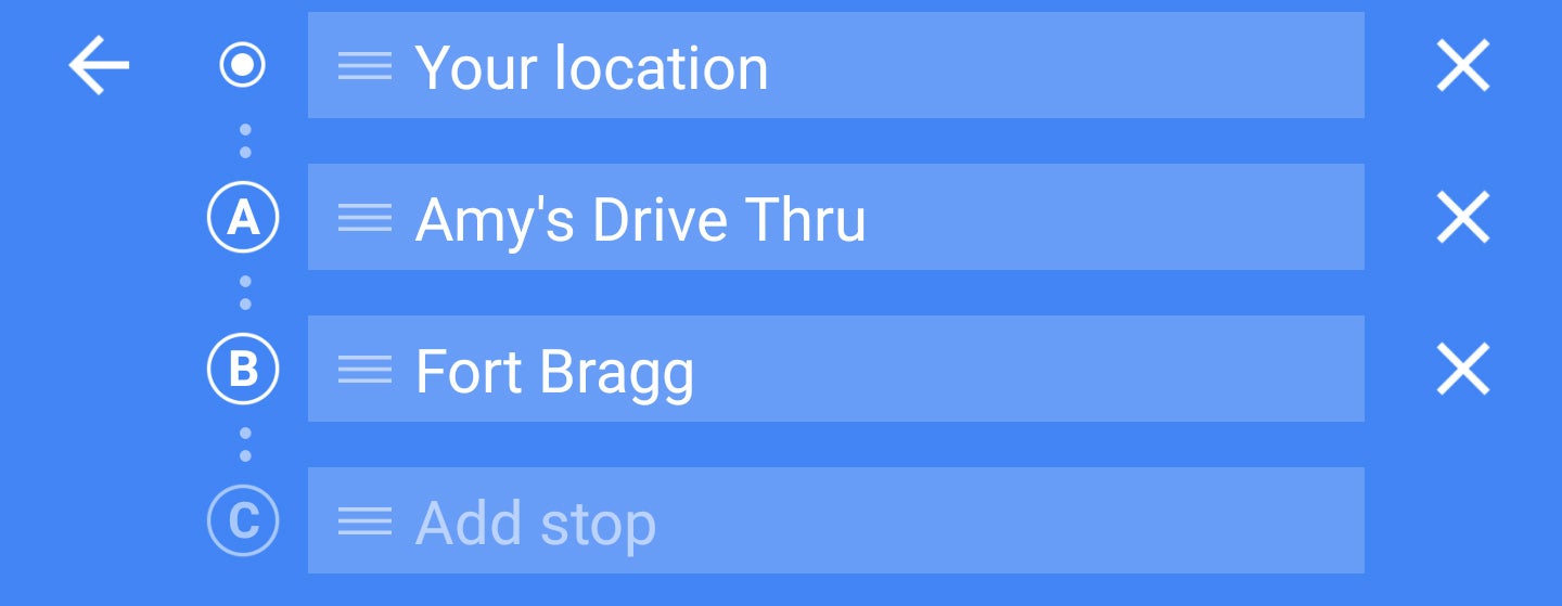 Google
 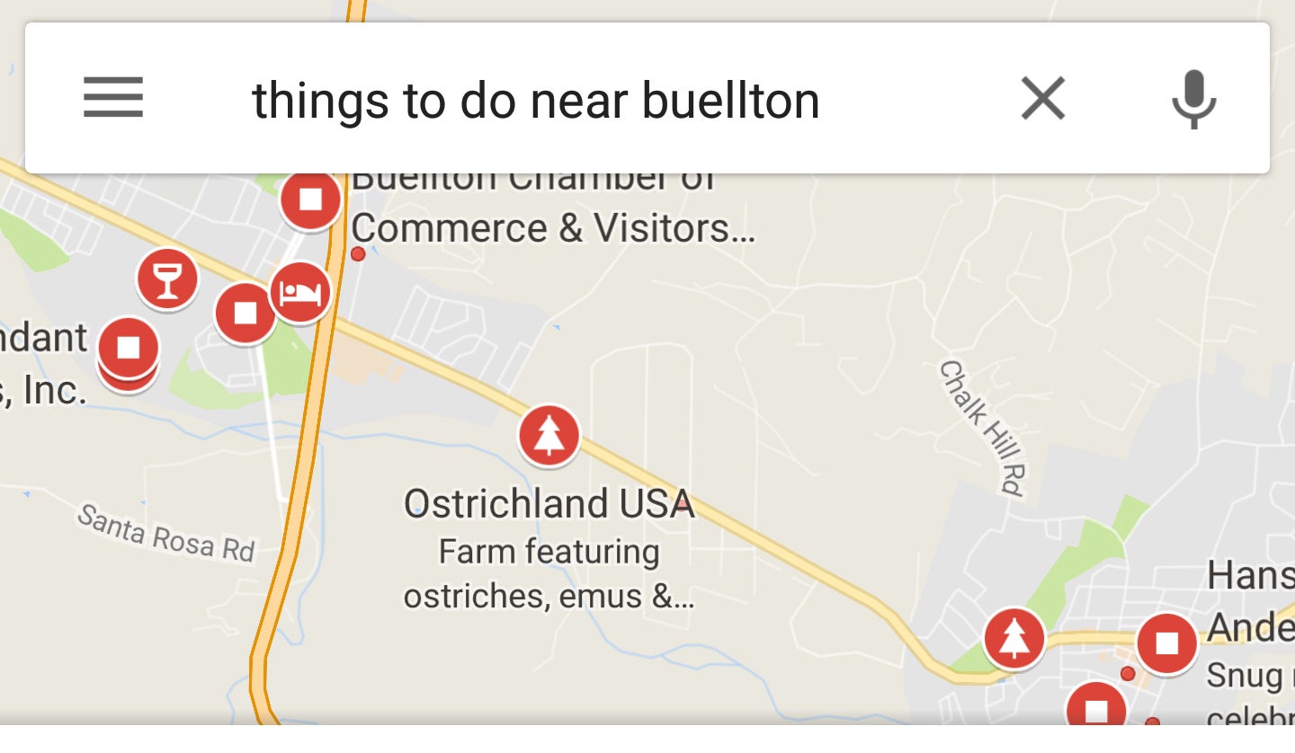 Google
  Google
 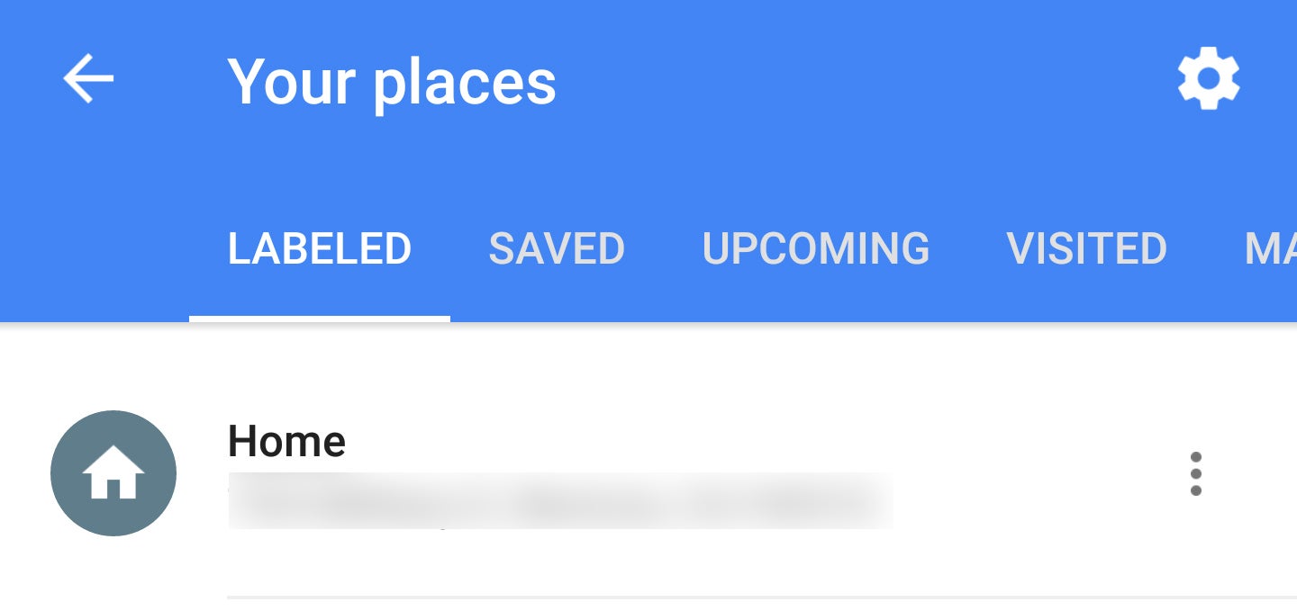 Google


No comments: